I subscribe to the MSQ Notices to mariners. I got sent one that said
"Queensland Notices to Mariners
226 (Permanent) of 2010
Brisbane pilotage area
Locality: Harry Atkinson Reef, Moreton Bay
Activity: vessel scuttled for reef extension
Refer to notice: 221 (P) of 2010
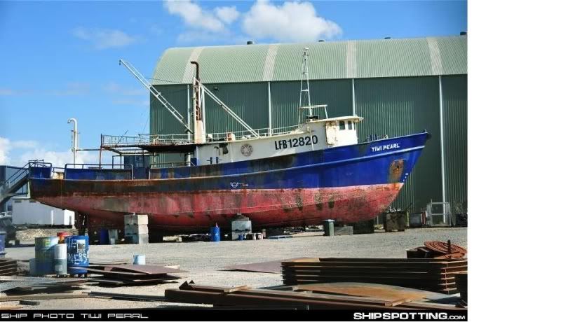
Mariners are advised that the least depth over the 'EX-TIWI PEARL' is 5 metres at Lowest
Astronomical Tide (LAT). Soundings have revealed that the ship lies in an east-west orientation.
The exact position has been updated to latitude 27° 24.532' S, longitude 153° 18.304' E
Mariners are advised to navigate with caution over the sunken ship and note the least depth."
On 16-03-2010 I posted that in the thread started by Phill called "Tiwi Pearl SUNK" here on Ausfish.
Those are the co-ordinates I used yesterday and they put me right on top of it. The Tiwi Pearl is actually a part of Harries .... I gather it just wasn't as close to the rest of it as they planned (until yesterday.... after I dragged it a bit closer

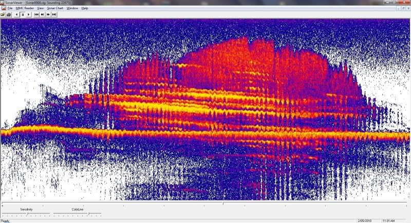
) I noticed as I was moving round it yesterday there are other lumps showing on the sounder and they had fish hanging off them. so there must be some stuff that has been dumped around it. Maybe they have been dumping stuff to try to connect it to the main part of the reef.... Seems to be a sensible idea... so, on reflection, I'm probably wrong in thinking that they did that.


 Reply With Quote


 ) I noticed as I was moving round it yesterday there are other lumps showing on the sounder and they had fish hanging off them. so there must be some stuff that has been dumped around it. Maybe they have been dumping stuff to try to connect it to the main part of the reef.... Seems to be a sensible idea... so, on reflection, I'm probably wrong in thinking that they did that.


 If I pull up an anchor next time I will give it back